
Australia’s vast mineral wealth is a reflection of a continent built on very old crust and repeatedly reshaped over billions of years. Ancient Archean cratons dominate the west (Pilbara and Yilgarn), broad sedimentary basins span the interior, and younger mountain belts along the eastern coast record volcanic events and tectonic collisions. This geological patchwork underpins everything from native gold and metallic sulphide ores to gem pegmatites, zeolites, opal and even diamonds.
Modern mineral history began with the 1851 gold discoveries at Ophir in New South Wales, followed by Ballarat and Bendigo in Victoria, sparking gold rushes that transformed settlement and mining. Besides finding gold, these revealed major deposits of other valuable minerals, including Broken Hill’s silver–lead–zinc ores and Burra Burra’s vast copper deposits.
Exploration today is more systematic, using geophysics, geochemistry and drilling to reduce economic risk and limit environmental damage. Most recently, a turning point for Australian mining came with the discovery of the Pilbara iron ore. As a result, hematite has become Australia’s dominant mineral export since the early 1960s, and operations such as Mount Tom Price (first shipment in 1966) and Mount Whaleback (opened 1968) have established the Hamersley Province in northeast Australia as a leading global iron-ore powerhouse. Increasingly, attention is turning to lithium and rare earth elements.
The sites described here show how specimens mirror their host geology – from oxidised zones and base-metal lodes to rare-element pegmatites, diamond pipes, telluride-rich goldfields, Cretaceous sediment-hosted opals, and enriched banded iron formations.
For a Map of Mineral Locations in Australia click HERE
|
Broken Hill, Yancowinna County, New South Wales
Rhodonite - Image Credit: Didier Descouens, CC BY-SA 4.0 Broken Hill, in far western New South Wales, is one of Australia’s most celebrated mining districts. The area was first explored by Charles Sturt in 1844, who named the Barrier Range and noted a ‘Broken Hill’ within the line of mountains. However, mining only began in 1883 when boundary rider Charles Rasp found silver-bearing outcrops on a remote sheep station. The discovery proved to be a rich lode of silver, lead and zinc, spurring the formation of the Broken Hill Proprietary Company (BHP) and helping to jumpstart Australia’s mining industry. The orebody turned out to be a 7-kilometre-long, crescent-shaped deposit known as the 'Line of Lode'. This feature formed approximately 1.7 to 1.8 billion years ago when volcanic activity on an ancient sea floor released hot, metal-rich fluids that cooled and settled into thick, rich layers of silver, lead, and zinc sulfides. These were later squeezed, folded and altered by a continental collision, rising to the surface as a jagged, rocky ridge. Weathering then transformed these primary minerals into spectacular secondary species, especially crystalline cerussite, pyromorphite, mimetite, and fine rhodonite. In places the oxidised zone extends down 200 metres, and spectacular, translucent, reticulated crystals of cerussite up to 28 centimetres across were once not uncommon. Eventually, more than 340 minerals were recorded from Brone Hill, and the region is the type locality for 26 species. When mining commenced, the deposit was divided into more than 40 blocks, which were worked for over a century, including highly productive areas grouped into the North, South and Central mines. Today production has mostly ceased, but the town of Broken Hill, popularly nicknamed ‘Silver City’, endures as a National Heritage-listed town, with museums and memorials preserving its industrial and cultural legacy. Apart from the classic lead minerals like cerussite and pyromorphite, Broken Hill is world-famous for its remarkable finds of silver halides, some being the largest crystals ever mined. Among these are specimens of marshite, miersite, embolite, bromyrite and iodyrite. In addition to their remarkable size and form, many of these occur in vibrant colours, including olive green and deep yellow. |
|
Mount Isa, City of Mount Isa, Queensland
Mount Isa Mine - Image Credit: denisbin, CC BY-ND 2.0 Mount Isa was discovered in February 1923 by John Campbell Miles, a part-time explorer and prospector. After finding cerussite and galena near the Leichhardt River, he wondered if he had found another Broken Hill. However, unlike Broken Hill’s mineral-rich outcrops, Mount Isa’s orebodies were narrow and seldom reached the surface, so the deposit had remained hidden for years. Drilling equipment was set up to trace these lead veins underground but soon discovered not only these ores but also immensely rich copper deposits. It turned out that the lead–zinc–silver bodies lie close together with copper veins but are distinct. The lead–zinc–silver mineralisation includes argentiferous galena, sphalerite and pyrite, while copper ore is dominated by chalcopyrite with pyrite. Geologically, the deposits lie in the Mount Isa Inlier, a complex geological province characterised by Proterozoic volcanic rocks, extensive granitic intrusions, and thick sedimentary successions deposited about 1.6 billion years ago. The lead-zinc-silver ores are hosted in shales, while the copper deposits lie in breccias resulting from major tectonic faults and orogenic events. By 1944 Mount Isa had become Australia’s largest copper and lead producer. In 1970 it produced 83,000 tonnes of copper and 156,600 tonnes of lead, becoming one of the world’s largest underground copper mines. Specimens greatly prized by collectors include vividly coloured pyromorphite in yellow, orange, and brilliant green, as well as spectacular cerussite, with the best specimens coming out in the 1930s. Among copper specimens, the most sought after are native copper and the chalcotrichite variety of cuprite. In addition, the area is known for about 280 different recorded minerals and four type locality species, which include cloncurryite, sieleckiite, stillwellite-(Ce) and barlowite. |
|
Rum Jungle, Batchelor, Coomalie Shire, Northern Territory
Cerussite, Pyromorphite and Malachite - Image Credit: Robert M. Lavinsky, CC-BY-SA-3.0 Rum Jungle, near Batchelor in Australia’s Northern Territory, was Australia’s first large-scale uranium mine, officially opening in 1954 and working until 1971. It supplied uranium to US and British nuclear programmes. The odd name originates from an accident in 1871 when a bullock cart delivering barrels of rum to construction gangs became bogged in jungle terrain near the headwaters of the Finnis River. The delivery men drank the rum in a week-long binge until they were rescued. The area thereby became known as Rum Jungle. The uranium mineralisation was first noted during an earlier Goyder’s 1869 survey, but it was not recognised as significant until 1949 when prospector Jack White collected distinctive green and yellow samples. These were initially unidentified but later turned out to be torbernite. Mining focused on several open cuts across the Rum Jungle mineral field, producing about 3,530 tonnes of uranium oxide and also 20,000 tonnes of copper concentrate. Geologically, the deposits belong to the Pine Creek Orogen province, with uranium systems developed in specific Paleoproterozoic sequences close to older basement rocks. Primary ore included uraninite with copper sulfides, most commonly chalcopyrite, while later oxidation generated powdery yellow-green uranium ‘ochres’ and secondary copper minerals. Poor waste management led to severe acid and metalliferous drainage, prompting major rehabilitation in the 1980s, though impacts have persisted. Although uranium specimens from Rum Jungle are rare, the location is especially known for its bright green botryoidal aggregates of malachite, often associated with pale yellow cerussite. |
|
Ophir / Bathurst, Wellington County, Bathurst, New South Wales
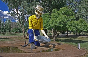
The Gold Prospector, Bathurst – Image Credit: Merryjack, CC BY-SA 4.0 The earliest recorded discovery of gold in Australia was made in 1823 at the Fish River between Rydal and Bathurst by assistant surveyor James McBrian, followed by auriferous pyrite noted by Count Strzelecki in 1839 and gold in quartz reported by Rev. W.B. Clarke near Hartley. These early finds were largely kept quiet, and it was not until April 1851 that Edward Hammond Hargraves recovered about four ounces of gold at Ophir, near Bathurst, triggering the first payable Australian gold rush. Within weeks, more than a thousand men were on the diggings, and by year’s end, the alluvial fields of NSW were world-famous. Between 1851 and 1927 the Ophir/Bathurst goldfield produced over 17 million ounces, peaking at about 800,000 ounces in 1852. Geologically, the gold occurs in hydrothermal quartz reefs and lodes that cut Silurian, Devonian, and Carboniferous rocks, with additional occurrences in conglomerates (Tallawang) and also in alluvial deposits of varying ages. Underground, the gold-bearing quartz is commonly accompanied by calcite, barite, and fluorite, while oxidised vein zones yield limonite, malachite, azurite, and cuprite. Associated sulfide ores include galena, arsenopyrite, pyrite, chalcopyrite, sphalerite, pyrrhotite, and stibnite. Other goldfields in NSW include Hillgrove, Adelong, Cobar, Lucknow and Wyalong, with the Mount Boppy mine being the richest gold-bearing lode discovered in the state. There are many different forms of collectible gold specimens from NSW, but small dodecahedra and octahedra, arborescent quartz clusters, and ‘moss gold’ are the most highly prized by collectors. |
|
Bendigo & Ballarat, Victoria
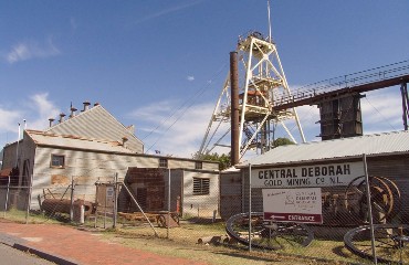
Bendigo Gold Mine - Image Credit: John, CC BY-SA 2.0 While there were known small gold finds in Victoria in the 1830s and 1840s, the decisive discovery occurred in 1851, when some prospectors tried their luck here, rather than heading off to join the gold rush in neighbouring New South Wales. Before long, the precious metal was found in the area stretching from Clunes and Warrandyte to Ballarat, Bendigo, and beyond. Production surged through the 1850s and 1860s, with Victoria ultimately yielding well over 71 million ounces of gold between 1851 and 1935, peaking at about three million ounces in 1856. The earliest finds of gold came from rich alluvial gravels worked by puddling, panning and sluicing, before mining followed the metal underground into auriferous quartz reefs. Ballarat, an area roughly 40 km², was famed for extraordinarily rich alluvial deposits at Golden Point and reefs exceeding 150 metres in depth. They produced spectacular nuggets, including the ‘Welcome Nugget’, found in 1858 at 55 metres, yielding 2195 ounces of fine gold, and dozens of others exceeding 1000 ounces. The veins typically carry white quartz and breccias with calcite, gold and sulfides, and Ballarat is particularly renowned for its sharp, isolated gold crystals – rhombic dodecahedra and cubo-octahedra – often up to 6 mm across, as well as fine gold-in-quartz specimens. Bendigo’s goldfield, northwest of Melbourne, on the other hand, had far less alluvial gold, so mining went underground much sooner. As early as 1860, over 200 mines were working in the area. They also went much deeper, many working 600 metres below the surface. Its reefs are characterised by white banded quartz, irregularly distributed free gold, and sulphides such as pyrite, galena, sphalerite and arsenopyrite. Bendigo is especially famous for showy specimen pieces of gold in glassy quartz, sometimes tinted green by chlorite, with albite, and also calcite in vugs. |
|
Coolgardie / Kalgoorlie (Golden Mile / Super Pit district), Western Australia
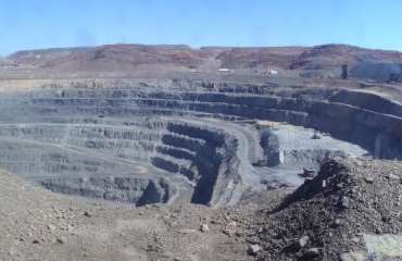
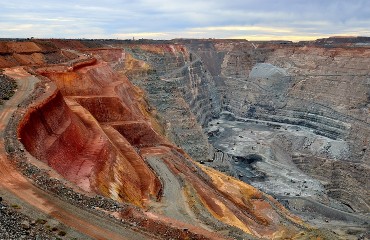
Kalgoorlie Super Pit - Image Credit: Bahnfrend, CC BY-SA 4.0 The discovery of gold at Coolgardie and Kalgoorlie happened much later than in New South Wales or Victoria. However, once found, the area quickly became famous for spectacular native gold specimens found as crystallised groups, rich aggregates, and large nuggets. The region’s gold story began with widely scattered discoveries at Kimberley (1882), Yilgarn (1887), Southern Cross (1888) and Murchison (1890). These early fields produced only about 80,000 ounces, but everything changed with the sensational finds at Coolgardie in 1892 and Kalgoorlie in 1893, which opened an immense gold province. More than 250,000 square miles of goldfields were under claim by 1895. At Coolgardie, gold occurs mainly in quartz reefs, typically enclosed within a quartz matrix and accompanied by pyrite, arsenopyrite, pyrrhotite, molybdenite and galena. Mines such as Bayley’s Reward became one of Australia’s famous producers, recovering hundreds of thousands of ounces before many closed in the 1960s. At Kalgoorlie the deposits are usually referred to as lode formations – zones of rock impregnated with native gold, pyrite, chalcopyrite and several other primary sulphides. The area’s gold belt stretches 8 kilometres past Kalgoorlie City town to Boulder City on the famous Golden Mile, regarded as the richest square mile block of auriferous ground in the world. The ore system is hosted largely in the Golden Mile Dolerite and associated structures, where generations of veins, breccias and alteration created a dense mesh of lodes. Historic mines included Great Boulder, Ivanhoe, Horseshoe, Perseverance, Oroya-Brownhill, Associated, and Lake View Consols, with Great Boulder’s shaft exceeding 800 metres. Many were later consolidated into the huge Fimiston Open Pit, nicknamed the Super Pit on account of its enormous size – 3.7 km long by 1.55 km wide and more than 660 m deep. Beyond scale and production, Kalgoorlie is globally renowned for its telluride-rich mineralogy, where much of the gold is bound in tellurides, making the district a classic for Au–Te chemistry and a rival to Cripple Creek, Colorado. Key minerals include calaverite, sylvanite, petzite and coloradoite, locally called kalgoorlite. Despite the fact that many specimens are either fine-grained or were processed for their gold value, enough specimens remain in collections to set Kalgoorlie apart from other common Australian quartz-native gold districts. |
|
Mount Lyell Mines, Queenstown, West Coast municipality, Tasmania
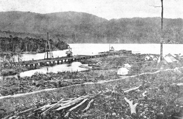
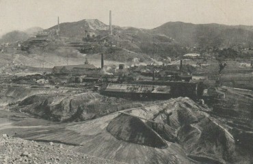
Mount Lyell Harbour c.1900 - Image Credit: Trainiac, Public Domain Although Tasmania was discovered by Abel Janszoon Tasman in 1642, no mineral prospecting was undertaken until 1859, when Charles Gould carried out a detailed geological survey of the island. Setting out west from Lake St. Clair, he discovered a mixed gold-copper lode under a mountain he named Mount Lyell. Mining for gold began in the early 1880s, but when the supply quickly ran out, the operation shifted to copper in 1891. Since then, the mine has been working continuously, with only one period of inactivity in the 1990s, making Mount Lyell the oldest operating copper mine in Australia. Initially the copper was extracted from an open cut 200 metres long, 75 metres wide and 140 metres deep. It was known as the Big Blow. However, more recently, ore extraction has moved underground by means of the Prince Lyell, North Lyell and South Lyell mines. Geologically, the deposit is usually linked to Cambrian volcanism, but late mineralised veins and minerals such as topaz, mawsonite, stannoidite and tourmaline suggest subsequent granite intrusions and later remobilisation. As a result, the Mount Lyell mines have produced excellent crystallised specimens of chalcopyrite, quartz, haematite, dolomite, ankerite, and other minerals, particularly in the late-stage veins. They also contain some rare minerals such as betekhtinite, florencite, woodhouseite, hessite, jalpaite, magnesiofoitite, zunyite, and stromeyerite. |
|
Dundas mineral field, Zeehan mining district, West Coast municipality, Tasmania
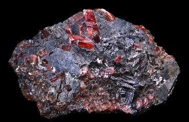
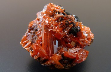
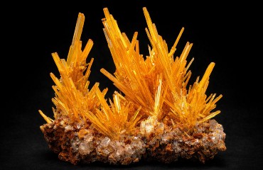
Crocoite - Image Credit: Jamain, CC BY-SA 3.0 Silver and lead deposits were first discovered in the Zeehan district in the late 1880s. The local geology consists of a series of slates, sandstones, and limestones that were later intruded by granite, serpentine, and diabase. The serpentinite encloses most of the silver deposits where the main source of the precious metal is argentiferous galena associated with sphalerite, tetrahedrite, bournonite, stannite, gersdorffite and nickeline. Where these primary ores have been oxidised, there are rich occurrences of rhodochrosite, pyromorphite, cerussite, anglesite, phosgenite, chalcophanite, evansite, stichtite and the type location mineral dundasite. At least 18 significant mines have worked across the wider Dundas-Zeehan ore field, including Sylvester, Susannite, Silver Queen, Comet, Anderson, and Bonanza. However, the Adelaide and Red Lead mines stand out for their occurrence of the stunning bright red lead-chromate crocoite. The mineral was first discovered in the 1890s at the Hazelwood Mine but was found at several others throughout the 20th century, where lead- and chromium-bearing hydrothermal solutions interacted with each other. Meeting in open cavities and fracture zones within the rocks resulted in spectacular crystals and clusters of red-orange crocoite. While most of the area’s mines have closed, specimen production at the Adelaide and Red Lead mines continues. The crocoite is often associated with limonite and goethite, together with numerous secondary lead minerals such as cerussite, dundasite and pyromorphite-group species. In specimen terms, ‘Dundas crocoite’ from these two mines remains a world standard – intense colour, sharp crystals, and dramatic associations that reflect the chemistry of this unusual supergene alteration, which also includes the type location minerals petterdite, philipsbornite and reynoldsite. |
|
Corinna-Savage River district, Waratah-Wynyard municipality, Tasmania
Savage River Mines - Image Credit: Ralph Bottrill, CC BY-SA 2.0 The Corinna-Savage River region in northwest Tasmania is one of Australia’s best-known magnetite iron mines. The ore here occurs as long, lens-shaped bodies in a narrow belt of ancient rocks, and it was noticed by early prospectors well before the modern mine was developed. Those rocks were later squeezed and heated deep underground, and that process helped concentrate the iron into bodies large enough to mine. Some gold also occurs in the area. However, Savage River is primarily known for its massive magnetite mineral specimens. It is heavy, black, metallic-looking, and strongly magnetic. Related iron minerals include hematite (including martite, which is hematite that has replaced magnetite) along with other minerals from the altered surrounding rocks. While many Australian iron mines are known for hematite-rich ore, Savage River stands out because magnetite is the main mineral, and the deposit is well mapped along its long, narrow trend. |
|
Aberfoyle Mine, Rossarden mining district, Northern Midlands municipality, Tasmania
Cassiterite and Quartz - Image Credit: The Assay House, Public Domain Near St. Mary’s on Tasmania’s northeast coast, the small mining villages of Rossarden and Storey’s Creek produced tin and tungsten from 1881 until the end of mining in the 1970s. A leading source was the Aberfoyle Mine near Rossarden, where the mineralisation occurs in parallel veins, typically 20 to 30 cm thick and extending up to 300 m. The veins were highly zoned, with muscovite on the outside, followed by cassiterite, tungstate, and sphalerite, progressing towards massive quartz in the middle. Open cavities within the quartz were often filled with exceptional crystallised specimens, especially cassiterite and scheelite. The accessory minerals included pyrite, chalcopyrite, arsenopyrite, galena, apatite, topaz, beryl, fluorite, amethyst, siderite, dolomite, and calcite. The finest cassiterite occurred as free-standing crystals averaging about 1.5 cm across but reportedly reaching 8 cm, often as lustrous black to brown multiple twins. Many are regarded as the best cassiterite specimens ever found in Australia. Tan-coloured scheelite crystals up to 1 cm occurred with clear quartz and often small dolomite rhombohedra. Although the site is abandoned, there are vast dumps of waste material containing other large and beautiful cassiterite specimens generally in/on quartz, with tungstate, muscovite, topaz and rare scheelite and phosphate minerals. |
|
White Cliffs and Lightning Ridge, New South Wales (black opal)
Opal Pineapple - Image Credit: James St. John, CC BY 2.0 New South Wales has produced some of the world’s finest precious opals, with the first recorded discovery made in the 1870s at Rocky Bridge Creek near the Abercrombie River. Both common and precious opals occurred there in vesicular basalt, showing vivid green, blue, and red colours. The state’s most important opal finds, however, came later from the inland sedimentary fields at White Cliffs and Lightning Ridge, including the districts around Grawin and Angledool. Opal was discovered at White Cliffs in 1884, reportedly when a bushman found broken fragments on the surface. Mining expanded rapidly after 1890, having to use an unusual method. The ultra-hard surface rock made vertical shafts virtually impossible, so miners drove tunnels sideways to follow opal-bearing seams in softer sandstone. White Cliffs is especially known for opal pseudomorphs after organic material and minerals, including wood and marine fossils. In addition, the location is also famous for its spherical ‘pineapple’ opals, which, whilst rarely gemmy, are fascinating opal pseudomorphs after ikaite. Lightning Ridge near the Queensland border, on the other hand, became world famous for black opal. How the discovery was made is unclear, but the first notable black opal was found in 1902 at the Six Mile diggings. Around 35 named mines, including Bald Hill, Butterfly and Hawk’s Nest, subsequently produced hundreds of stones with brilliant colour play against a dark potch background, including many legendary named stones. Among these are the Aurora Australis, the Flame Queen, the Pride of Australia, the Empress, the Red Admiral Stone, the Pandora, the Light of the World and the Star of Bethlehem. Of these, the Red Admiral Stone is considered to be the most beautiful opal in the world. Once again, the area also holds opalised fossils, including plants, shells and vertebrate material preserved as silica. The theory of precious opal formation proposes deep weathering of volcanic rocks and silica mobilisation, ending in precipitation within open spaces such as seams, fractures and cavities left by fossils. |
|
Coober Pedy, Pastoral Unincorporated Area, South Australia (white/crystal opal)
Opal Doublet - Image Credit: Dpulitzer, CC BY-SA 3.0 Coober Pedy lies in South Australia’s Stuart Range, about 750 kilometres northwest of Adelaide and roughly 260 kilometres north of Kingoonya on the Transcontinental Railway. The opal field extends over a large area, being around 60 kilometres long by 15 kilometres wide. Unlike most other Australian opal districts, which have volcanic origin, Coober Pedy lies in sedimentary rocks, with opal forming in the Early Cretaceous Bulldog Shale of the Rolling Downs Group. Weathering and bleaching created favourable horizons for silica to migrate and precipitate as opal. The mineralisation is highly localised within these altered rocks, and the opal occurs as nodules, in veins and seams, and along vertical joints, and it also commonly replaces fossil burrows or the remains of ancient marine organisms. The field was discovered sometime between 1911 and 1914, with the first miners arriving by the end of 1915, and Coober Pedy has been worked continuously since, becoming the world’s most famous opal town. The climate is extremely arid and lacks timber, forcing miners to live in underground dugouts to escape the heat. This led local Indigenous people to call the area Kupapiti, or “white fellow in a hole”, anglicised to Coober Pedy. Collectors value the district for bright white and crystal opal, as well as abundant opalised fossils of shells and belemnites. A specimen of opal found in 1956 measuring 25 centimetres across and weighing 4 kilograms has been preserved and remains the largest uncut gem opal in existence. Named the Olympic Australis and valued at $2.5 million Australian dollars, it consists almost entirely of pure light opal full of pinpoints of bright fire. Otherwise, the area has been intensely studied to understand how sediment-hosted opal develops in a basin setting rather than in volcanic rocks. |
|
Andamooka, South Australia (matrix/crystal opal)
Precious Opal - Image Credit: James St. John, CC BY 2.0 The Andamooka opal field is a relatively recent discovery about 160 km northeast of Pimba. It is smaller than Coober Pedy as a producer, but it is renowned among collectors for its distinctive specimens of matrix and crystal opal. The field was discovered in 1930 when two well diggers on Andamooka Station, Roy Shepherd and Sam Brooks, went out one evening to shoot rabbits for meat. Roy picked up a colourful stone and tossed it to Sam, joking, “Catch this one Sam, it’s a pretty one”, the first precious opal found on the field. Geologically, Andamooka opal occurs in Cretaceous sediments of the same Bulldog Shale as Coober Pedy, commonly within a bleached, deeply weathered zone where silica-rich fluids travelled through pores and fractures, cementing and replacing the host rock. In some cases, the silica has filled cavities left by the imprints of fossil shells or other marine organisms, producing very attractive animal-shaped specimens. Overall, the most common opal variety in Andamooka is crystal opal, a white form with a strong internal play of colours. The location is also known for matrix opal, a type of microporous opal that often shows a weak display of colours when mined. However, this is enhanced by first soaking the stone in a strong sugar solution and then boiling it in sulfuric acid. The hot acid carbonises the sugar, intensifying the black background, thereby enhancing the play of colours. This product is a legitimate gemstone, providing it is labelled as treated matrix opal. |
|
Pilbara Iron Deposits (Mount Whaleback, Greater Mount Tom Price) Western Australia
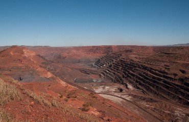
Mount Whaleback - Image Credit: PDTillman, CC BY 2.0 The Pilbara region of Western Australia is the heart of Australia’s modern iron ore industry, originally built around giant open pits such as Mount Tom Price and Mount Whaleback (Newman), along with major mining settlements like Paraburdoo, Marandoo, Brockman, Yandicoogina, and more recent developments including Area C, South Flank, Cloudbreak and Christmas Creek. The deposits were first discovered in the mid-1950s and developed by Rio Tinto beginning in the 1960s. The Tom Price mine was the first to open, followed by Mount Whaleback, which is now the area’s leading producer. There are currently 15 separate operations run by Rio Tinto, BHP and FMG, some combined together to work as shared hubs. The combined output exceeds 600 million tonnes of iron ore per annum, making the region the largest producer of iron on the planet, rivalled only by Brazil. The majority of the ore is moved by rail to the port of Dampier on the north coast and shipped worldwide from there. Geologically, these deposits are high-grade sedimentary banded iron formations (BIF) in the Hamersley Group, especially the Brockman and Marra Mamba iron formations, upgraded by alteration, leaching and weathering into iron-rich bodies. They are often highly folded into synclines, which brings them close to the surface. They contain hematite and magnetite accompanied by chert and lesser iron carbonates and silicates. The deposits are often capped by a further layer of post-weathering goethite. Due to large-scale mechanised mining, mineral specimens are rare. However, when they do come to light, they consist of hematite (massive, specular and microplaty), martite (hematite pseudomorphs after magnetite), and goethite (often botryoidal), with banded chert/jasper, dolomite and quartz as associated minerals. |
|
Koolyanobbing (Yilgarn Iron Province), Western Australia
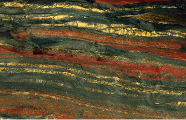
Banded Iron Formation - Image Credit: James St. John, CC BY 2.0 Koolyanobbing is another iron province in Western Australia, albeit much smaller than Pilbara, which lies 900 kilometres to the north. Like the Pilbara, it is based on banded iron formation, but here the ore is hosted within Archean greenstone belts, producing structurally complex, strongly deformed deposits rather than Pilbara’s more uniform Hamersley sequences. Multiple hydrothermal and supergene activities subsequently created varied ore styles, including replacement of chert bands and carbonate-rich horizons. Even so, the ore composition is broadly similar to Pilbara, consisting of high-grade hematite, magnetite and goethite, along with jaspery chert and quartz. The name of the area derives from a local Indigenous word meaning ‘place of large rocks’, fitting the rugged landscape. Iron mining began at Dowd’s Hill in 1948 to supply the Wundowie iron plant, and surveys in 1952 outlined major ore that led to later expansion. Today, five main mining areas extend for roughly 60 kilometres along the northwest-trending Koolyanobbing greenstone range, with ore taken by rail to the port of Esperance. Mineral specimens are uncommon but can be visually appealing, including botryoidal goethite and several hematite habits (specularite, hematite mica', and martite), with limonite and minor magnetite on ironstone or banded iron matrix. The area is also dotted with hundreds of mostly abandoned gold mines and trials, which led prospectors here in the first place. These also stretch along the greenstone belt from Bullfinch through Southern Cross and onto Marvel Loch, though collectible specimens from these are rare. |
|
Middleback Range (Iron Knob/Iron Monarch/Iron Duke), Eyre Peninsula, South Australia
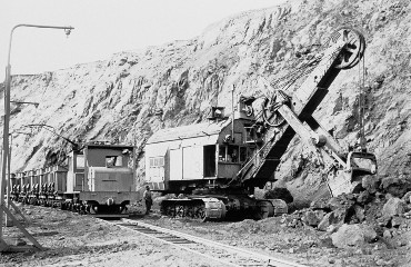
Iron Knob Mining c.1950 - Image Credit: The History Trust of South Australia, CC0 1.0 The Middleback Range sits inland from Whyalla on the Eyre Peninsula and has supplied iron ore for more than a century. In 1915, BHP opened Australia’s first major iron ore mine at Iron Knob, followed by the Iron Monarch, the Iron Duke and others within the Iron-Prince group. Until 1965 and the discovery of other iron deposits, like those at Pilbara, these were the main source of ore for Australia’s iron and steel industry, helped by the short distance to the port of Whyalla and later by their own integrated steelworks established in 1964. Geologically, the deposits are hematite and magnetite bodies hosted within banded iron formations and related Early Proterozoic sediments of the Hutchison Group on the Gawler Craton. The area continues to produce iron today and is worked as multiple open pits across three main operating areas (South Middleback Ranges, Iron Baron, and Iron Knob). For collectors, noteworthy specimens include dense massive hematite, specular hematite, goethite/limonite, magnetite, and martite. Unusually for an iron field, Iron Monarch is also famous for abundant, well-crystallised phosphate minerals in cavities and alteration zones, including fluorapatite and a wide secondary phosphate suite. Among these are several type location species: cloudite, gatehousite, kleemanite, waterhouseite and whiteite. Beyond Middleback, the Eyre Peninsula offers remarkably varied mineral collecting. Lake MacDonnell near Penong is Australia’s largest gypsum operation, known for gypsum and selenite. The Uley area hosts a rare graphite mineralisation. Farther west, Jacinth-Ambrosia is a major zircon producer with rutile and ilmenite. North of Cowell, Australia’s key nephrite jade deposits occur in marble-associated bodies. |
|
Olympic Dam, Roxby Downs, Pastoral Unincorporated Area, South Australia
Olympic Dam Mine - Image Credit: Uwe Kolitsch, CC BY-SA 2.0 Olympic Dam is a huge copper–gold–uranium mine on Roxby Downs Station in outback South Australia, about 25 km west of Andamooka. It was discovered in 1975 when Western Mining Corporation drilled areas suggested by geophysical surveys, and mining began in 1988. Today, Olympic Dam is Australia’s largest known reserve of copper and uranium and is often claimed to be the world’s biggest uranium deposit. The orebody sits deep underground in ancient granite and is made up of broken, iron-rich rock that has been cemented back together by mineral-bearing fluids. Most of it is not “collector-grade” material, but it contains enormous volumes of copper and uranium minerals. The chemistry of the deposit varies from place to place – some zones are richer in magnetite and pyrite, while others are dominated by hematite and copper sulfides such as chalcopyrite, bornite and chalcocite. More recent veins also carry quartz and barite. For mineral collectors, the standout finds came in the late 1980s and early 1990s, when mining cut into open cavities in a gold-rich area known as B-block. These pockets produced impressive butterscotch-yellow barite crystals, along with sharp calcite ‘dogtooth’ crystals, round siderite crystals, colourful fluorite (purple, green and clear) and flat anhydrite plates. Uranium occurs mainly as uraninite, which can appear as tiny cubes, coarser zoned crystals, web-like forms, or dense massive fillings. Similar, but far smaller, deposits in the South Australian region include Prominent Hill and Carrapateena. |
|
Reaphook Hill, Martins Well Station, Flinders Ranges, South Australia
Scholzite - Image Credit: The Assay House, Public Domain Reaphook Hill is a 180-metre peak in South Australia’s eastern Flinders Ranges, about 480 km north of Adelaide, best known in recent decades for fine collectible crystals rather than ore production. A zinc-phosphate occurrence near the hill’s base was identified by the South Australian Geological Survey in the early 1960s, but the remote setting and harsh conditions meant mining attempts never became viable. The deposit carries a suite of secondary minerals dominated by zinc phosphates, especially scholzite, with tarbuttite, parahopeite, collinsite and phosphophyllite. Associated species include rockbridgeite and carbonates such as smithsonite and siderite, the zinc silicate hemimorphite, and manganese oxides including chalcophanite, psilomelane, manganite and pyrolusite. Type location species include hillite and reaphookhillite. The most striking and famous specimens, however, are colourful scholzite crystals in white, pink, yellow and green, occurring as needle clusters, up to 2.5 cm, or “Roman Sword” crystals, sometimes darkened to black-gold by cryptomelane coatings, with notable parahopeite, popular with collectors and museum collections. |
|
Yinnietharra, Upper Gascoyne Shire, Western Australia
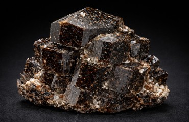
Dravite - Image Credit: The Assay House, Public Domain Yinnietharra, about 800 km north of Perth, is a region famous for producing some of the world’s finest dravite tourmaline crystals. The highly remote deposit was discovered in 1918 and initially mined for muscovite used in the electrical industry between 1922 and 1946 and then for beryl and columbite between 1942 and 1965. Attention subsequently turned away from commercial mining to gem specimen hunting, lasting between 1969 and the early 1990s. During this time, more than 20 tonnes of dravite crystals were recovered, nearly three-quarters having high-quality complete euhedral form. As a result, many worldwide museums and private collections contain these extraordinary specimens. The best examples are either brown or black crystals, some weighing up to 11.5 kg, with 15-centimetre-long crystals being quite common. The black crystals were initially thought to be schorl, but analysis has shown their composition to be identical to dravite. Both sets of crystals often occur in parallel clusters. Many individual forms are highly symmetrical, resembling dodecahedral garnets. Associated minerals include rutile, apatite, zircon, and fluorite. Geologically the deposit consists of pegmatites created in Archean times by the collision of the Yilgarn and Pilbara Cratons. The associated granite intrusions caused the alteration of local rocks to gneisses, schists and migmatites, while circulating hydrothermal solutions deposited numerous pegmatite minerals, including the dravite, columbite, diopside and various types of mica. The entire Yinnietharra pegmatite field is widespread, but the most important tourmaline deposits are centred around the Morrissey Hill area, in two northwest-trending outcrops of muscovite and schist over a distance of approximately 25 kilometres. |
|
Greenbushes Mine, Bridgetown-Greenbushes Shire, Western Australia
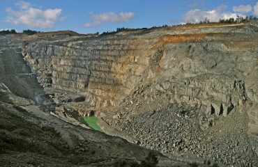
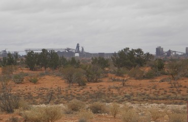
Greenbushes Mine - Image Credit: Calistemon, CC BY-SA 4.0 Greenbushes is a major open-pit tin–tantalum–lithium mine in southwest Western Australia. Older specimens from the area may be labelled ‘Lemonade Springs, the name of an earlier pit just south of the modern-day Cornwall Pit operation. The deposit was discovered in 1881 and first worked for alluvial cassiterite, using screening, sluicing and small dredging operations. As grades and profits fluctuated, mining became intermittent until large-scale, modern operations resumed after World War II. Changes in ownership followed, with open-pit mining for tin and tantalum expanding from the early 1970s, and commercial spodumene (lithium) production beginning in 1983. Tin production ceased in 2007. Geologically, Greenbushes is a huge, strongly deformed and weathered granitic pegmatite (an LCT-type rare-element pegmatite) about 2.5 km long, with zones enriched in albite plus tantalum–tin minerals and in spodumene along one side. The mine has been one of the most intensely studied in Western Australia. Accordingly, the deposit is estimated to contain half the world's known reserves of tantalum and is the largest lithium resource in the world. The mine produces many interesting, rare minerals but few large attractive crystals for most species. Well-formed, coarse schorl and holmquistite crystals are known, but only microcrystals of the tantalum-bearing minerals. Greenbushes is the type and only locality for the complex iron-lithium inosilicate ferro-holmquistite. |
|
Argyle Diamond Mine, Wyndham-East Kimberley Shire, Western Australia
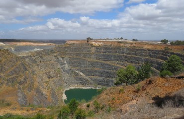
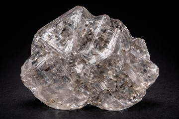
Skeletal diamond crystals - Image Credit: The Assay House, Public Domain Argyle lies a few miles south of Lake Argyle in East Kimberley and is the famous AK1 diamond-bearing lamproite pipe. As such, Argyle changed diamond geology by proving a world-class mine could be hosted in rocks other than kimberlite. Exploration in the region began in the early 1970s, mainly for uranium or any other useful ores. Instead, in 1979, alluvial diamonds were found in Smoke Creek upstream from their source, the AK1 pipe. Legend says the initial discovery was a diamond spotted in an anthill. The discovery was then kept intensely secret while a prior lease on the land expired. Even decoy stakes were pegged elsewhere to misdirect rivals. Eventually, mining of the alluvial deposits began in 1983, followed by open-pit production from 1985 and finally a shift to underground mining from 2013. Operations ended in 2020. Overall, Argyle produced over 800 million carats of rough diamonds, mostly near-gem material, and supplied roughly 90–95% of the world’s prized pink diamonds, plus tiny quantities of ultra-rare red stones. Less attractive brown and dark stones were marketed as champagne and cognac diamonds. Unusually, many of Argyle’s diamonds fluoresce blue or dull grey under UV light and blue-white under X-rays. Geologically, AK1 is a diatreme of deep-mantle olivine lamproite (tuffs and lavas), with diamond-rich sandy tuff at the top of the pipe. Alteration has largely destroyed most primary minerals, leaving mainly phlogopite and chromite, while marginal breccias carry zeolites and clays. The pipe is also the type locality for lucasite-(Ce). |
|
Central Harts Range, Northern Territory (Mount Palmer mica-pegmatites)
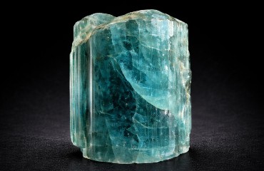
Beryl - Image Credit: The Assay House, Public Domain The Harts Range is one of Australia’s most remote mineral localities, about 190 km northeast of Alice Springs and reached mainly by dirt roads via the Stuart and Plenty Highways. Despite the isolation, it became an intermittent mica district from the late 1800s to the mid-20th century, with numerous shallow pegmatite workings scattered across rugged, arid country. Its mineralisation reflects a long geological history. An ancient basement of Irindina Gneiss was later covered by sandstones, mudstones and minor limestones deposited in a former sea. Later mountain-building events folded and faulted these rocks and introduced volcanic material. Cambrian pegmatites then cut through the older units, and Devonian uplift brought the terrain closer to the surface, where erosion exposed the pegmatites. Reactions between the pegmatites and the surrounding metamorphosed rocks created excellent conditions for well-formed mineral specimens. For collectors, the classic Harts Range mineral is muscovite in large “book” crystals, but the district is also notable for its variety of high-quality gemstones. At least 25 gem species are recorded, including tourmaline (schorl, elbaite), beryl (aquamarine, heliodor), zircon, garnet (almandine, hessonite), chrysoberyl, kornerupine, kyanite, sapphirine, ruby corundum, and quartz varieties (smoky, amethyst, sceptres), along with feldspars (sunstone, moonstone, microcline, albite), titanite, epidote, and apatite. Locality data is often vague – many pieces are simply labelled “Harts Range” or “Harts Ridge” – because workings are poorly named and collectors can be reluctant to share exact sites. The range also hosts minor base-metal occurrences, with the Winnecke and Arltunga goldfields and the Jervois copper deposits nearby. |
|
Kingsgate Molybdenum Deposits, Gough County, New South Wales
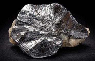
Molybdenite - Image Credit: Robert M. Lavinsky, CC-BY-SA-3.0 Kingsgate, located in northeastern New South Wales, is the state’s most important molybdenite–bismuth-arsenic district and has produced a large share of NSW’s molybdenite. The deposits lie about 30 kilometres east of Glen Innes, where mineralised pipes and veins of hydrothermal origin cut granitic rocks of the local mountain range. At least 54 small pipes are known, typically 1 to 2 metres deep. There is no Kingsgate Mine as such, but rather a series of mines, often grouped simply as Kingsgate. Some were worked collectively as the Yates Mines. The ore field was worked for molybdenum and bismuth mainly from about 1890 to 1930, but a handful of mines on some pipes yielded ores until the mid-1950s. Historic specimen material can be outstanding, including enormous molybdenite masses (one reputedly over a tonne) and world-class, broad, platy, metallic crystals up to about 15 centimetres across. Native bismuth occurs as hefty masses (reported up to 15 kilogrammes), with joséite, bismuthinite, arsenopyrite, and clear rock-crystal quartz druses. The area is the type locality for kingsgateite. Most of the area’s dumps have been bulldozed over the years, and it is very difficult to establish where exactly specific material comes from or which particular mine or pipe site. The lack of certainty means that it is probably best to simply label material from these mines as Kingsgate. |
|
Garrawilla Volcanics, Pottinger Co., New South Wales
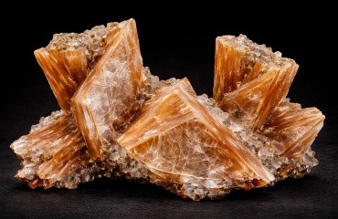
Heulandite - Image Credit: The Assay House, Public Domain Garrawilla, in the Warrumbungle Ranges of New South Wales, about 25 kilometres northwest of Tambar Springs (near Mullaley), is a classic Australian zeolite locality. The minerals occur in vugs and seams within Jurassic olivine basalts and trachytes spread across roughly 900 km², with cavities reaching about 1.5 m wide. There are scores of individual zeolite outcrops in the area, many being located along Garrawilla Creek. Hydrothermal solutions circulating within these rocks deposited many striking zeolite species, including stilbite and heulandite, which dominate. The stilbite forms pale pink to bright orange, sheaf-like sprays up to 12 cm, often dusted with drusy quartz, while heulandite occurs as orange (sometimes chocolate) fan-shaped clusters to about 7 cm. Another striking mineral is stellerite, which occurs as salmon-coloured, bladed crystals up to 6 cm in length. Other associates include analcime, laumontite, natrolite, calcite, quartz, and prehnite. Most specimens come from historic collections, as collecting on site is severely restricted. |
|
Anakie, Central Highlands Region, Queensland
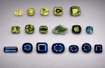
Sapphires of different colour form Anakie - Image Credit: The Assay House, Public Domain The Anakie District, about 300 kilometres west of Rockhampton in central Queensland, has been Australia’s most productive source of gem sapphires. Discovered in the 1870s during gold prospecting, the stones occur in alluvial material spread over roughly 50 square kilometres, with key commercial workings at Retreat Creek, Policeman Creek, Tomahawk Creek and Central Creek. The sapphire-bearing wash is often clay-rich and can reach about 15 metres thick at Tomahawk Creek, where gravel was traditionally washed in water-filled log troughs and hand-sorted. Colours range from blue and green to yellow, purple, and parti-coloured stones, with Anakie especially noted for rich golden sapphires and occasional chatoyant material cut as star cabochons. Although large-scale mining declined after the discovery of rich sapphire deposits in East Africa in the 1960s, some small-scale ventures continue, and separate areas have been set aside for amateur collecting, subject to obtaining a licence. |
|
Mount Morgan, Rockhampton Region, Queensland
Mount Morgan mine c.1908 - Image Credit: Kaye, Public Domain Mount Morgan Mine lies at Mount Morgan, about 39 kilometres south of Rockhampton in central Queensland. Discovered in 1882, it became known as the ‘Mountain of Gold’ and remained one of Australia’s most important copper-gold mines for decades. Early mining took place underground around the famous ‘Glory Hole’, but after a disastrous fire in 1927, the operation shifted to open-cut mining from 1928. All active mining eventually ended after World War II due to the exhaustion of its gold deposits, but reprocessing of the old dumps continued until 1990. The deposit is a volcanic-hosted, pyrite-rich, gold, and copper sulphide system with strong hydrothermal alteration. At its peak in the early 1900s, it was among the world’s leading gold producers before evolving into a major copper producer as well. Mount Morgan is noted for exceptionally pure native gold, with contemporary assay reports recording fineness up to about 99.8% Au, placing it among the purest native gold in Australia. Modern specimens are rare, but when old collections resurface, they yield native gold in quartz, pyrite, chalcopyrite, pyrrhotite, magnetite, and colourful oxidised gossan minerals. |
|
Burra Burra Mine, Burra, Goyder Regional Council, South Australia
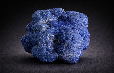
Azuite Nodule - Image Credit: JJ Harrison , GNU 1.2 The Burra Burra Mine lies beside the town of Burra in South Australia’s Mid North, about 150 km north of Adelaide. Copper ore was discovered here in 1845 when a shepherd found a green-stained rock at Burra Burra Creek, sparking a boom that helped to sustain the young colony at the time. Initially called the ‘Monster Mine’, it produced roughly 50,000 tonnes of copper metal between 1845 and 1877, with a later open-pit revival, now as Burra Burra between 1969 and 1981. Geologically, the orebody is hosted within a layer of the Skillogalee Dolomite known as the ‘Kooringa Member’. The mineral formation began about 790 million years ago, mainly along big cracks and lines in the rock, and it was significantly improved later by a process that enriched the minerals in the oxidised zone. Near the surface, the copper ore occurs in irregular patches rich in azurite and malachite, while deeper workings follow two north–south veins – Allen’s Lode and Kingston’s Lode – carrying even richer deposits with azurite, malachite, cuprite, tetrahedrite, atacamite and native copper. For collectors, Burra Burra is celebrated for its many vivid secondary copper minerals. These include large quantities of banded and botryoidal malachite, resembling the material from the Urals, which was often used for ornamental purposes. Azurite commonly formed rounded nodules studded with radiating crystals, known as ‘azurite roses’ and comparable to classic specimens from Bisbee and Chessy. Small clusters of native copper were also common, often showing skeletal, hopper-like depressions and occasionally dusted with cuprite crystals. Burra Burra’s showpiece, however, is atacamite – sharply terminated crystals found singly or in clusters on matrix, with exceptional examples reaching about 7.5 cm in length – ranking among the best atacamites known. Today, most specimens must be acquired from old collections since mineral collecting at Burra Burra is no longer permitted. |

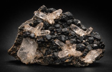
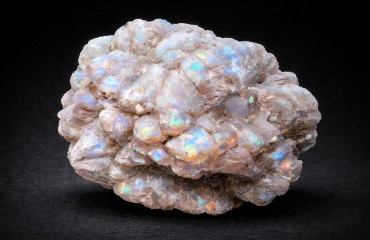
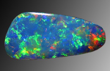
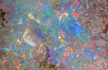
Australia’s mineral wealth is extraordinary, built from an ancient continent with many different rock types and a long, complex history. Major deposits helped open up the interior, driving new towns, railways and ports as prospectors and miners pushed into remote country. Classic localities include Broken Hill for galena, sphalerite and secondary lead minerals, Mount Isa for sulphide ores, and Dundas for world-famous crocoite. Western Australia adds Kalgoorlie’s telluride-rich gold and Greenbushes pegmatites with spodumene and tantalum minerals. The Great Artesian Basin hosts iconic opal fields such as Lightning Ridge, Coober Pedy, Andamooka and White Cliffs. Today the Pilbara’s vast iron ore and the rising importance of lithium point to a bright resource future, while gems like opal continue to come from harsh, isolated landscapes where geology still rewards persistence.
If you are interested in adding specimens from Australia to your collection, click HERE


