
The reason for two countries in Africa sharing the word 'Congo' in their name has roots in the colonial division of the continent at the Berlin Conference in 1884/5. Accordingly, lands north of the River Congo were allocated to France, while the vast inland territory south of the river was taken by Belgium. Both colonies developed and were ruled separately until independence in 1960. Having little in common, they decided to keep their separate identities, the south becoming the Democratic Republic of the Congo (or Zaire between 1971 and 1997) and the north becoming confusingly the Republic of the Congo. Trying to avoid ambiguity, the north is sometimes called Congo-Brazzaville, while the south is called Congo-Kinshasa, after their respective capital cities.
As well as having distinct histories and cultures, the two countries have completely unique geological and mineralogical profiles. The Democratic Republic of the Congo (DRC) hosts some of the world’s most famous collector localities, especially in the Katanga / Central African Copperbelt, where copper–cobalt deposits and their supergene oxidation zones produce extraordinary malachite, azurite, cobalt oxides, and rare uranium-copper minerals. Beyond Katanga, the DRC also includes globally important pegmatites (lithium–tin–tantalum) and tin districts in the east, plus historic diamond fields in Kasai. The Republic of the Congo (RC or Congo-Brazzaville) is not as well-known for collector specimens, but it still has some significant areas with lead-zinc oxidation groups and beautiful supergene copper minerals, along with large industrial resources like potash and iron deposits. Below are the most notable localities for both countries, labelled as DRC for the south and RC for the north.
For a Map of Mineral Locations in the Congo click HERE
|
Kolwezi mining district (Kamoto–Musonoi–Mashamba), Lualaba, DRC
Malachite and Chrysocolla - Image Credit: Robert M. Lavinsky, CC-BY-SA-3.0 Kolwezi lies in the south of DRC’s Lualaba District (part of the former and dissolved Katanga Province) in a body of rocks known as the Katanga Supergroup. These form the northern end of the Central African Copperbelt, a 500-kilometre-long metallogenic province extending into Zambia and one of the world’s most important sediment-hosted Cu–Co districts. Copper mining began here in prehistoric times, but modern commercial open-pit operations began in the 1940s at Musonoi. Kamoto began underground production in 1969, operating until the 1990 closure. Mashamba began work in 1978 as two open-cast pits about 5 kilometres to the west. All three were later combined and redeveloped, reopening in the 2000s under the Kamoto Copper Company and now owned by the Chinese company Sino-Congolaise des Mines. Geologically, the Copperbelt’s mineral deposits originally formed from hydrothermal solutions circulating through ancient Neoproterozoic sediments, leading to copper and cobalt sulfides precipitating in distinctive layers within older dolomites, siltstones and shales. A later continental collision folded, faulted and uplifted these sequences. Closer to the surface these primary sulfides were now subjected to intense tropical weathering, creating zones of secondary oxidised minerals and widespread concentration and enrichment, including uranium. The combination of events explains why Kolwezi is so specimen-rich – the weathered zones yield thick crusts and fibrous masses of malachite and azurite, plus dozens of rare copper, cobalt and uranium species. Overall, the Kolwezi region is widely known for large masses of dense malachite used for ornamental carving. However, each of the mines has considerable mineralogical interest in its own right. Mashamba is probably the least diverse but still offers outstanding cobalt-bearing calcite, cuprite, baryte, metatyuyamunite, carnotite, vesigniéite, kolwezite, spherocobaltite and malachite. Kamoto is known for approximately 60 minerals, including 5 type locality species: astrocyanite-(Ce), françoisite-(Nd), kamotoite-(Y), pendevilleite-(Y) and shabaite-(Nd). Several of these, and other minerals like uraninite and zeunerite, contain uranium. The Musonoi mine, however, is the most complex mineralogically, being known not only for copper, cobalt and uranium minerals, but also selenium (as uranyl selenites) and palladium. To date almost 90 different minerals have been recorded, including 7 type location species: demesmaekerite, derriksite, guilleminite, kolwezite, marthozite, oosterboschite and verbeekite. Many of these and others carry uranium. However, there is some uncertainty whether all these species came form Musonoi because the dump where they occurred served numerous mines. The question is unlikely to be solved because the dump was reprocessed between 1992 and 1993. |
|
Tenke–Fungurume district, Lualaba, DRC
Cobaltoan Calcite - Image Credit: The Assay House, Public Domain The Teneke-Fungurume district lies in Lualaba District approximately 80 km east of Kolwezi and is also at the northern end of the Central African Copperbelt. While some copper mining has taken place here since antiquity, modern activity only began in the mid-2000s, with the first copper being produced in 2009. Since then, mining has expanded across several open pits and various satellite deposits extending west to east over a distance of about 40 km, centred on the town of Teneke and ending just outside the town of Fungurume in the east. Some named operations include Kwatebala, Tenke, Fungurume, Fwaulu, Kansalawile and Mambilima. Like Kolwezi, the ores occur in layered sedimentary rocks of the Katanga Supergroup that were later folded and faulted, so the mineralised layers are repeated and broken into slices underground. Although not as mineralogically diverse as Kolwezi, the weathering has concentrated the ores in oxidised zones far more extensively, making Tenke–Fungurume widely regarded as one of the world’s largest and richest copper–cobalt resources. For collectors, the area is famous because the ores are chalcocite and chalcopyrite with minor carrollite, bornite and digenite, while weathering has turned primary sulfides into colourful secondary minerals. Common species include malachite, azurite, chrysocolla, connellite, covellite, cuprite, as well as cobalt-rich minerals like heterogenite and cobaltoan calcite. Rarer minerals are also recorded from the Tenke-area, including buttgenbachite, claringbullite and hermannroseite. |
|
Kipushi district, Haut-Katanga, DRC
Reichenbachite - Image Credit: Ji-Elle, CC BY-SA 3.0 The Kipushi mineralisation lies in the south of DRC’s Haut-Katanga District (part of the former and dissolved Katanga Province) next to the town of Kipushi, about 35 km southwest of Lubumbashi and very close to the Zambia border. It is another region on the African Copper Belt, roughly halfway along its length from north to south. Local people worked copper here long before industrial mining, but the first modern mine (then the Prince Léopold Mine) started in 1924 as an open pit and became a deep underground operation by 1926. It ran until 1993, when operations stopped amid economic and political disruption. Other workings in the area include the Lupoto, Luiswishi, Lukuni, Kinsevere and Musoshi mines. Geologically, the region has seen considerable weathering of its primary ores, leading to an unusually rich spectrum of secondary copper minerals. Among more than 130 reported species, six are type locality minerals: briartite, gallite, kipushite, reinerite, sengierite and zincobriartite. The Kipushi mine itself is famous for major copper minerals such as chalcopyrite and bornite. However, it is also a rich source of zinc, mostly as sphalerite, whose production sometimes outstripped copper. What also makes Kipushi special for collectors is its germanium mineralisation, specifically in the form of the type location minerals renierite and briartite. Near the surface, weathering has created scores of colourful secondary species, which has led some collectors to remark that Kipushi has produced a ‘whole museum’ of minerals. At depth, the veins worked by the mine extend over the border into Zambia. |
|
Lubumbashi district, Haut-Katanga, DRC
Cornetite - Image Credit: Robert M. Lavinsky, CC-BY-SA-3.0 Lubumbashi, formerly known as Élisabethville during Belgian occupation, is the third-largest city in the DRC, located in the country's southeasternmost part, along the border with Zambia. The area only has a single notable mine, the L'Etoile du Congo Mine, but the city is significant for mineral collecting since many Congolese minerals are simply labelled as 'Lubumbashi' without further location details. Part of the reason is that the city, being the main settlement in this part of the DRC, acts as the hub for nearly all mineral movements from the Copper Belt, whether processed copper or mineral specimens. Consequently, when these arrive here from surrounding locations, it is easier for local mineral traders to simply label them as Lubumbashi, rather than to provide more specific origin details. This fact is particularly true when dealing with common minerals in the region like malachite and azurite. The city itself grew around the L'Etoile du Congo Mine, which began working in 1910 and has been producing copper and cobalt on and off since. Like Kipushi and others, it sits in the Central African Copperbelt, where copper- and cobalt-rich layers reach the surface and have been oxidised. Common specimen minerals include malachite and azurite, chrysocolla, cuprite, and cobalt minerals such as heterogenite, plus copper phosphates like pseudomalachite and libethenite. This mine was also where the first new mineral for Congo was discovered, cornetite, which was named in honour of Jules Cornet, a Belgian geologist who carried out the first detailed mineral surveys of the Congo. Another location nearby is the Ruashi Mine, about 10 km from Lubumbashi, worked from an open cut since 1911, also for copper and cobalt. |
|
Kambove/Likasi district, Haut-Katanga, DRC
Carrolllite - Image Credit: The Assay House, Public Domain The Kambove–Likasi district lies in Haut-Katanga, in southeastern DRC, at the heart of the Central African Copper Belt. Likasi is about 138 km northwest of Lubumbashi, and Kambove is roughly 25 km away. Copper was first reported here by Belgian prospectors in 1892. Afterwards, Likasi was founded in 1917 to become a major copper- and cobalt-mining centre, including the Shituru site, whose open-cast mine was eventually abandoned by 1992. Around Kambove, mining included open-pit working at Kambove West (1959–1965), alongside Kambove Principal Mine, Kamfundwa Mine, Kamoya Mine, Shangulowé Mine, and other pits and underground developments. The ores in the wider region are again sedimentary copper and cobalt deposits, later folded and weathered into colourful secondary minerals. Typical specimen minerals include malachite, chrysocolla, cobalt-bearing calcite, cuprite, libethenite, heterogenite, plancheite and chalcocite. The Kamoya South mine is famed for its superb specimens of octahedral carrollite, while the M'sesa Mine, located 2 km north of Kambove, is the type location for the rare copper oxyhalide claringbullite. |
|
Shinkolobwe Mine, Haut-Katanga, DRC
Curite, Kasolite & Metatorbernite - Image Credit: Robert M. Lavinsky, CC-BY-SA-3.0 Shinkolobwe lies in the Haut-Katanga province, about 20 km west of Likasi (Jadotville), roughly 20 km south of Kambove and around 145 km northwest of Lubumbashi. Historically, the location is one of the most significant uranium mines in the world, noted for exceptionally rich ore that fed early nuclear programmes in the USA and Europe and for a long legacy of strategic mining. The uranium orebody was first identified in 1915 by geologist Robert Rich Sharp, after he noticed unusually coloured rocks during copper prospecting which turned out to be radioactive. Commercial mining began in 1921 under Union Minière, initially for radium and then increasingly for uranium. Production was scaled back in the 1930s, then restarted during WWII, and Shinkolobwe later became a major source of uranium used by the United States in the Manhattan Project era. Geologically, the mine is unusual since it lies on the Central African Copper Belt, better known for copper and cobalt. However, in the late stages of the area’s formation, uranium-bearing fluids moved through cracks in local sedimentary rocks – mainly siliceous dolomite and dark shales of the local ‘Mines Series’ – depositing exceptionally high-grade uranium ores. Subsequent weathering and oxidation converted these into a uniquely diverse suite of secondary species. While the mine is best known for uraninite as the primary ore mineral, collectors typically seek the oxidised-zone uranyl minerals – often bright yellows and greens – formed in these near-surface alteration zones. To date, besides more common species like torbernite and becquerelite, Shinkolobwe has produced more than 140 rare and sometimes unique uranium-bearing species. Among these are more than 40 type locality species, including billietite, kasolite, curite, sharpite, soddyite and richetite. Minerals that are highly prized and define many classic radioactive collections. Provenance is usually given simply as ‘Shinkolobwe Mine’, though older material can have historical label variants. |
|
Manono–Kitotolo, Tanganyika, DRC
Spodumene - Image Credit: The Assay House, Public Domain Manono–Kitotolo is an enormous pegmatite district in Tanganyika Province around the town of Manono, roughly 500 km north of Lubumbashi. The main pegmatite field is nearly 800 m wide and extends for more than 15 km. Tin was first reported here in the early 1900s, and cassiterite mining began in 1915, continuing until the mid-1980s, by which time an estimated 140,000 tonnes of cassiterite concentrate had been produced. The deposit also proved rich in niobium and tantalum ores (mainly as columbite and tantalite), yielding about 4,500 tonnes of columbite–tantalite concentrate. Manono–Kitotolo is celebrated because of its sheer size and its unusual content of “rare elements”. As the original molten intrusion cooled, it concentrated tin, niobium, tantalum, and lithium into coarse crystals and ore pockets, explaining both the cassiterite and columbite–tantalite production and today’s growing interest in spodumene. Current estimates describe it as one of the world’s largest lithium reserves, with 30 million tonnes of spodumene at 6% lithium oxide. The pegmatites also contain small amounts of uranium, which was never mined commercially but appears near the surface as bright autunite and possibly uranocircite. Other collectible minerals include spodumene, petalite, lepidolite, beryl, tourmaline, fluorite, quartz and feldspars, plus rare tantalum minerals such as the type-locality species cesplumtantite and thoreaulite. |
|
Bisie (Mpama North/Mpama South), Walikale, North Kivu, DRC
Bisie Mine - Image Credit: Google Maps, Google Maps Bisie is a major tin district in Walikale Territory, North Kivu, in eastern DRC, about 60 km northwest of the territory’s centre and roughly 180 km northwest of Goma. Large amateur workings initially began in an area on Bisie Ridge, becoming widely known in the 2000s for hand-dug cassiterite mining. Some of this was used to fund various military factions during the country’s political troubles. Modern state-controlled development began in 2015, opening two main deposits, Mpama North and Mpama South, later growing into the DRC’s largest commercial producer of cassiterite. The mineralisation occurs in the Mesoproterozoic Kivu Belt, a chain of eroded hills created by the collisions of various truly ancient continents. The area was later intruded by granites, followed by volcanism and faulting, during which hydrothermal solutions deposited several metallic elements, including tungsten, lithium, niobium, and tantalum, with tin being commercially the most important. The tin orebodies often approach a thickness of 8 metres and are typically encased in a thick envelope of altered granite in the form of chlorite and actinolite. The cassiterite is in the form of ‘wood tin’ and is highly concentrated. At 4.5% tin, the Bisie Tin Mine is renowned for being the world’s highest-grade tin mine. Cassiterite is the most prized mineral among collectors, but the high level of granite alteration and contact metamorphism between the granite and its surrounding sedimentary rocks has also produced a large suite of metamorphic species, including tourmaline, monazite, magnetite, biotite, talc, staurolite, muscovite, and various feldspars and garnets. Among the other minor metallic ores are chalcopyrite, galena, bornite, pyrite, pyrrhotite and sphalerite, often accompanied by quartz. |
|
Lueshe Mine, Lueshe carbonatite complex, Bwito, North Kivu, DRC
Lueshite - Image Credit: Robert M. Lavinsky, CC-BY-SA-3.0 Lueshe is in Rutshuru Territory, North Kivu, in eastern DR Congo, around 150 km north of Goma, in the wider Virunga/Kivu region. The deposit is unusual because it formed from a carbonatite intrusion – an igneous body rich in carbonate minerals – about 2 by 3 km in size and roughly 800 million years old, emplaced in much older hard rocks. Its economic value comes from niobium, mainly hosted in the mineral pyrochlore. Over time, tropical weathering broke down the surface of the carbonatite and concentrated pyrochlore into softer, near-surface material that could be processed into niobium concentrate. For collectors, Lueshe is famous for the niobium mineral lueshite, discovered here in 1959 and named after the locality. Exploration partnerships were in place by 1960, and industrial mining developed in the 1980s. However, production was repeatedly disrupted, with long closures, partly because of armed conflict and partly because of ownership changes, and the mine’s licence has been revoked by the DRC government since 2016. Specimen minerals recorded include pyrochlore (and altered varieties such as hydropyrochlore), lueshite, calcite and dolomite (the main host matrix), apatite, baryte, celestine, plus accessory rock-forming minerals like aegirine, feldspars and pyroxenes. Rare-earth minerals such as ancylite-(Ce), parisite-(Ce), monazite-(Ce) and synchysite-(Ce) are also listed. |
|
Tshibwe Mine, Mbuji-Mayi (MIBA/Bakwanga), Kasai, DRC
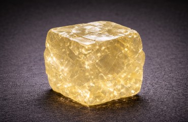
Diamond - Image Credit: The Assay House, Public Domain The Tshibwe Mine lies in south-central DRC, 20 km southwest of the city of Mbuji-Mayi, popularly known as the ‘diamond city’, and as Bakwanga under former Belgian occupation. The settlement itself was originally built to house miners working a local diamond mine, but the stones could also be easily found in the area's waterways, making it possible for anyone to collect them. In fact, the diamonds were so widespread that occasionally the town’s buildings and homes, including those of the mine directors, were sometimes demolished to access the stones. Historically, diamonds were first reported here in the early 1900s, but the deposit’s true value only became clear after a major find at Mbuji-Mayi in 1918. Mining grew rapidly under colonial-era companies and was, for decades, among the world’s largest producers by volume, running Mbuji-Mayi as a closely managed company town. Output typically averaged about 5 million carats per year, but less than 10% of the diamonds were of gemstone quality. Instead, the stones were largely directed at industrial uses, and for many years the Mbuji-Mayi mine supplied 80 percent of the world's industrial diamonds. Eventually, however, the deposits were exhausted, and the hunt for new diamonds moved to other areas. Such efforts eventually led to the discovery of the diamond’s original source, a kimberlite pipe in the Miabi area, where the Tshibwe Mine began working the exposure. Nevertheless, despite the departure of mining, Mbuji-Mayi continued to grow and is now the capital of Kasaï-Oriental Province and the second largest city in the DRC. The Tshibwe mine, on the other hand, grew to become the DRC’s largest, although very sporadic, producer. Local corruption means that there is ongoing conflict between the mine’s private owners and the DRC’s government, causing wide fluctuations in production, sometimes ceasing altogether. Furthermore, the importance of the country’s diamonds has fallen sharply due to foreign supply, so that the DRC’s share of world markets has fallen to less than 18% of industrial diamonds and less than 3% of gem-quality stones. For collectors the key mineral is diamond and minerals associated with, and indicative of, kimberlite intrusions, including chlorite, and various garnet and olivine varieties. |
|
Mindouli mining district, Pool Department, RC
Plancheite and Dioptase - Image Credit: The Assay House, Public Domain Mindouli is the Republic of the Congo’s best-known copper district, located in Pool Department on the main RN1 road and the Pointe-Noire–Brazzaville railway, close to the border with the DR Congo. The mineralised ground lies within a limestone escarpment behind the town of Mindouli, where copper-bearing rock occurs for about 3 kilometres, creating a string of small exposures rather than one single, dominant deposit. Overall, mining has been intermittent and continues today, but the most productive period was under French control from 1948 to 1960. That work left a patchwork of small pits, trenches and prospects matching individual outcrops, which is why specimens are usually labelled ‘Mindouli’ or ‘Mindouli district’ rather than a specific mine name. The geology is relatively simple, consisting of highly fractured former marine limestone which have been infiltrated by copper-rich hydrothermal fluids, leaving copper minerals behind. Later, in the hot, wet tropical climate, the near-surface primary copper deposit was altered by weathering, producing the colourful secondary minerals common today. Some lead, zinc, and iron ores are also present, and open spaces in the rock are often lined and filled by secondary copper minerals. For mineral collectors, Mindouli is most strongly associated with vivid green malachite, typically as crusts and cavity linings. The location is also rich in deep green dioptase (often sharp crystals), aurichalcite, fornacite, chalcocite, azurite and native copper, along with a wider supporting suite of secondary copper minerals from the district. Mindouli is the type location for the complex inosilicate plancheite, which occurs as pale-blue, botryoidal clusters. |
|
M’Fouati Mine, Bouenza Department, RC
Hemimorphite - Image Credit: The Assay House, Public Domain M’Fouati is the Republic of the Congo’s best-known lead-zinc-manganese district, located in the Bouenza Department in southern RC, about 55 km west of Mindouli. The mineralised ground is centred on a large limestone hill near the town. Unlike a single location, the area is best thought of as a central mine plus several small satellite prospects within a few kilometres, which is why specimens are often labelled simply ‘Mfouati’ or ‘Mfouati Mine’. The geology consists of cracked and faulted limestone filled with a hydrothermal deposit consisting mostly of manganese-rich material, often referred to as wad. However, many of the fractures also carry lead and zinc ores, which were the target for mining activity. The primary sulfide ores of these metals were highly weathered by tropical rain and oxygen near the surface, creating a rich weathered zone full of colourful secondary species prized by collectors. M’Fouati is especially known for sharp cerussite and bright wulfenite, alongside hemimorphite and smithsonite. Copper minerals are also reported, including azurite, dioptase, malachite, and chrysocolla, and mimetite and descloizite from the wider area. |
|
Yanga–Koubenza deposit, Bouenza Department, RC
Aurichalcite and Rosasite - Image Credit: The Assay House, Public Domain Yanga–Koubenza is primarily a zinc occurrence in the Bouenza Department of RC, featuring a set of quarries and open pits set within a patchwork of extensive exploration zones. It was intensively prospected in the 1940s and 1960s, and a detailed commercial viability audit was carried out in the mid-1980s for the Congo Ministry of Mines when the main prospect was primarily an open pit roughly 150 m long and 20 to 30 m deep. The deposit is best described as an oxidation-zone base-metal deposit, where instead of primary sulfides, the ore is almost exclusively ‘weathered’ metal minerals. Consequently, the audit reported the material to consist entirely of oxidised zinc minerals, whose concentration was attempted using gravity methods aimed at recovering zinc oxides, since no sulfides were visible in the pit. Modern mining began in 2016 with underground reserves estimated at more than 5 million tonnes, composed of 8% lead, 7% zinc, and less than 2% copper, with zinc being the main reason for mining. For collectors, the mine is famous for striking crusts of highly crystalline, shiny, blue rosasite, smithsonite and hemimorphite, all secondary zinc minerals. The mine is also known, but not commonly, for its lustrous, light smoky-coloured cerussite twins and uncommon deep blue blocky crystals of azurite and blue-green aurichalcite. |
|
Holle / Kola, Kouilou Department, RC
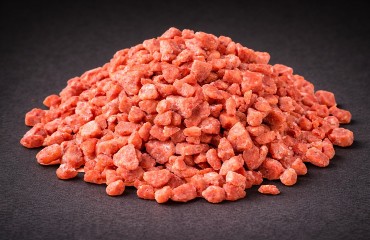
Sylvite - Image Credit: The Assay House, Public Domain The Republic of the Congo is one of the few countries in sub-Saharan Africa with major potassium reserves, which occur in the form of potash, a mix of various potassium chlorides. The best-known exposures lie in the coastal region of RC, where thick layers of ancient evaporites formed when seawater repeatedly flooded and dried out, leaving behind potassium-rich salts that were later buried underground. The best example is the Lower Cretaceous Holle deposit, where potash occurs at depths of roughly 400 to 700 m below the surface and is rich in carnallite and sylvite. Holle was mined in the 1970s, producing mainly sylvite (KCl) at up to 450,000 tonnes per year, before production stopped when the mine flooded in 1977. Today, the country’s modern potash focus is the Sintoukola area, further inland, and its flagship Kola mine. The ore here occurs as a high-grade shallow deposit (275 m) and consists of evaporate potash with alternating beds of clay and sand. The main source of potassium is a mix of sylvite and carnallite. Evaporite minerals of other elements are also often present, including anhydrite (calcium), bischofite (magnesium), halite (sodium) and tachyhydrite (calcium and magnesium). The region is the type locality for the rare borate evaporite mineral congolite, named after the country. For collectors, specimen minerals are mainly sylvite, carnallite, and halite – attractive but fragile and highly humidity-sensitive – and should therefore be stored in dry conditions. |
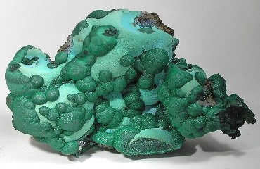
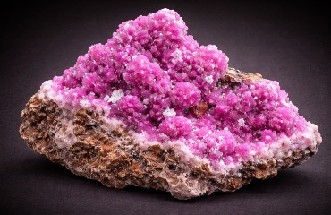

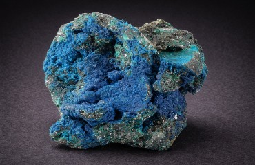
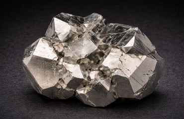
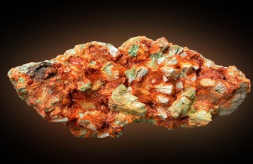
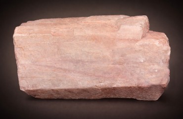
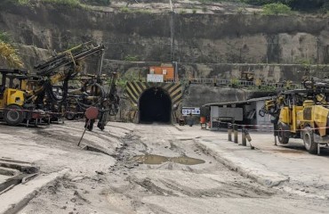
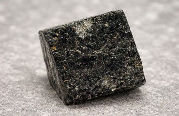
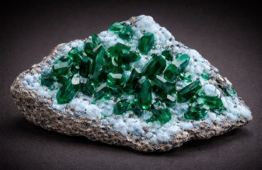
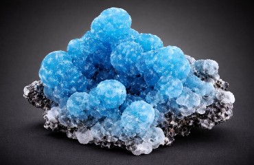
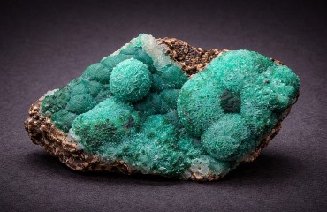
Taken together, the two Congos show both the wonder and the cost of mineral wealth. The Democratic Republic of the Congo contributes some of the world’s most iconic collector material – malachite, azurite, chrysocolla and cobalt minerals from Kolwezi in the Central African Copper Belt, the legendary radioactive rarities of Shinkolobwe, and the 'pegmatite classics' of Manono–Kitotolo alongside Bisie cassiterite, Lueshe niobium minerals and Kasai diamonds. Congo-Brazzaville, while less conspicuous in the specimen trade, adds genuinely worthwhile oxidation-zone suites from Mindouli and M’Fouati, plus distinctive industrial localities such as Yanga–Koubenza’s zinc oxides and the coastal potash salts.
But these minerals are never just collecting objects: they come from landscapes reshaped by pits, waste dumps and roads, and from communities whose lives are tied to boom-and-bust cycles, safety risks, armed conflict and contested ownership. For collectors, the Congos offer extraordinary mineral diversity and scientific significance – yet they also ask for care: accurate provenance, respect for legal and ethical supply chains, and an awareness that every specimen has a human and environmental footprint.
If you are interested in adding specimens from the Congo to your collection, click HERE


